17th Avenue South Corridor Study
5th Street South to Approximately 350' West of 51st Street
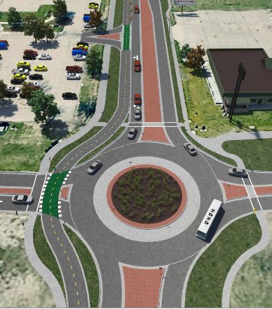
17th Ave S is a heavily-used collector roadway the traverses the City of Fargo from east to west. The corridor spans from the Red River/5th St (at the entrance of Lindenwood Park) to the Fargo/West Fargo city boundary. From there the roadway continues west into West Fargo for several more miles. 17th Ave S is bordered by both residential and commercial land uses. East of I-29 the corridor abuts mostly residential land uses while west of I-29 the land uses are mostly commercial. The roadway varies in width ranging from a two-lane roadway to a 4-lane roadway.
The purpose of this study is to address the many needs along the corridor. These needs include: traffic congestion, high crash rates, poor pavement condition, lack of bicycle accommodations, lack of pedestrian crossings, and more. Metro COG in cooperation with City of Fargo and consulting firm KLJ developed this study. The study began in the summer of 2017 and was completed in the summer of 2019. A final draft of the study can be found on this page.
Project Contact Information
Dan Farnsworth
701-532-5106
Fargo-Moorhead Metropolitan Council of Governments
Case Plaza, Suite 232
One 2nd Street North
Fargo, ND 58102